


Airplane Charts Instrument Flight Rules IFR (H) app for iPhone and iPad
Developer: SendFreeFax.net
First release : 03 Jun 2013
App size: 38.74 Mb
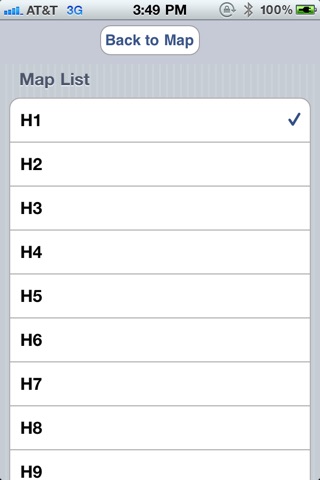
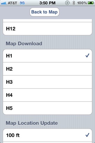
This is app contain all lower 48 state USA Instrument Flight Rules (IFR) high altitude charts and viewer for iPad and iPhone. This app is built on high performance display engine for fast scrolling and zooming with brightest and sharpest moving charts. Current GPS location is displayed in the IFR charts with an airplane icon. All 12 IFR navigation charts are provided free of charge. IFR navigation charts can be downloaded offline for viewing while flying. All downloaded IFR charts are fully functional in airplane mode. IPad version of IFR navigation charts are very useful with much more detail view with large display. This IFR chart viewer is fully self contained and does not require a WIFI or 3G/4G wireless connection. The current location is displayed with a green airplane icon. IFR Airplane Chart Viewer will detect current location and prompt to select the best map based on current location. If the current location is outside the selected map, GPS will be be disabled and proper map name will be prompted to select. This app is an excellent boost to situational awareness without an expensive subscription. This app support iPhone, iPad, and iPad Mini.
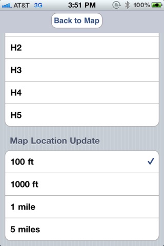
Use Maps button to download IFR maps to iOS device and then select map to current display screen. Only one map can be selected from the Map Downloaded list at a time. Map update setting provide how often current location on the map will be updated. Use this setting to save battery life by limiting GPS update duration.
Questions and comments reply to us at: iphone at airplanegroundschools.com
airplane charts, IFR charts, navigation charts, aeronautical maps, flight maps, aeronautical charts, approach plates, AeroNav IFR Charts,high altitude enroute charts, air navigation charts, flight charts